
Monday
1/5/26 at 0:21
Winter Weather Advisory issued January 4 at 7:12PM CST until January 5 at 3:00AM CST by NWS Green Bay WI
* WHAT...Mixed precipitation. Additional snow accumulations up to one
inch and ice accumulations up to a tenth of an inch.
* WHERE...Waushara, Calumet, Manitowoc, Winnebago, Brown, Kewaunee,
Menominee, Outagamie, Shawano, and Waupaca Counties.
* WHEN...Until 3 AM CST Monday.
* IMPACTS...Slippery road conditions.
* ADDITIONAL DETAILS...While the precipitation will end early Monday
morning, road impacts may still occur into the Monday morning
commute time.
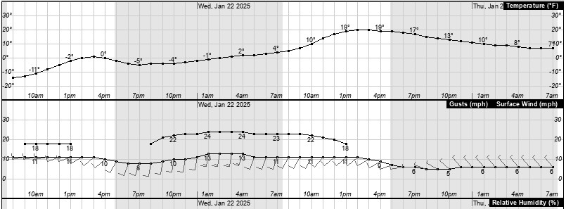
Temperature
Humidity
Barometer
Wind
26.1°F
(FEELS LIKE) 26.1°F
85%
(8% 24hr change)
28.83
(-0.31" 24hr change)
0.0 - SSW
Wind Gust(0.0 mph)
Temperature Chart
Dew Point-Humidity Chart
Precipitation Chart
Solar Radiation


Wind Chill
RH and Dew Point
Miscellaneous
Almanac
Current Wind Chill
26.1°F
Low Wind Chill-Today
25.9°F
Low Wind Chill Time
0:00
Heat Index
31.0°F
Low RH Today
85 %
Low RH Time Today
0:00
Low RH Yesterday
72 %
Current Dew Point
22.2 °F
Solar Radiation
0
Evapotranspiration
0.00"
Structure
62.2°F
Low Dewpoint Today
22.0 °F
Sunrise
7:33
Sunset
16:32
Moon Rise
19:27
Moon Day
#17
Daily Rainfall
Monthly Rainfall
Yearly Rainfall
24 Hour Rainfall
Since midnight
0.00"
Total
0.00"
Total
0.00"
24 Hour Rainfall
Or Snow Melt
0.00"
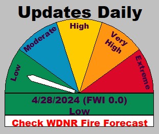
Waupaca Fire Danger
Surface Temps
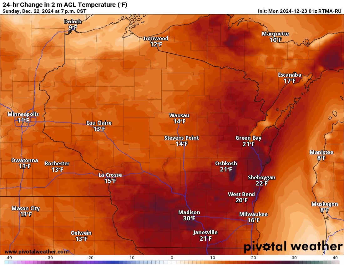
24-Hr Temp Change
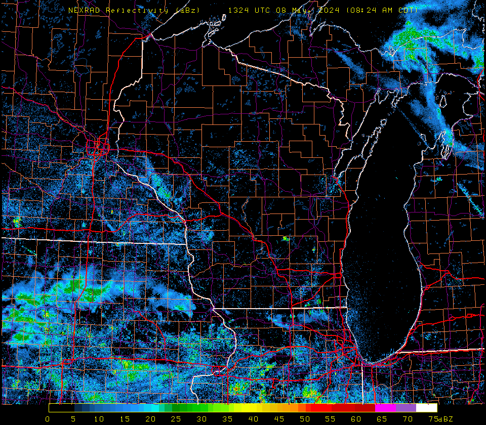
Saint Cloud Radar
Link-WDNR Burn Restrictions
click to enlarge
click to enlarge

click to enlarge
Aviation Wx Center
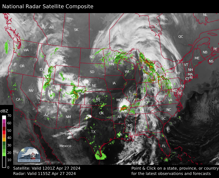
Midwest Radar
Wisconsin Radar
Lightning Map
click to enlarge

click to enlarge
click to enlarge

click to enlarge
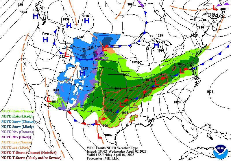
Day 1 Weather Map
Day 2 Weather Map
SPC Day 1 Tornado Outlook
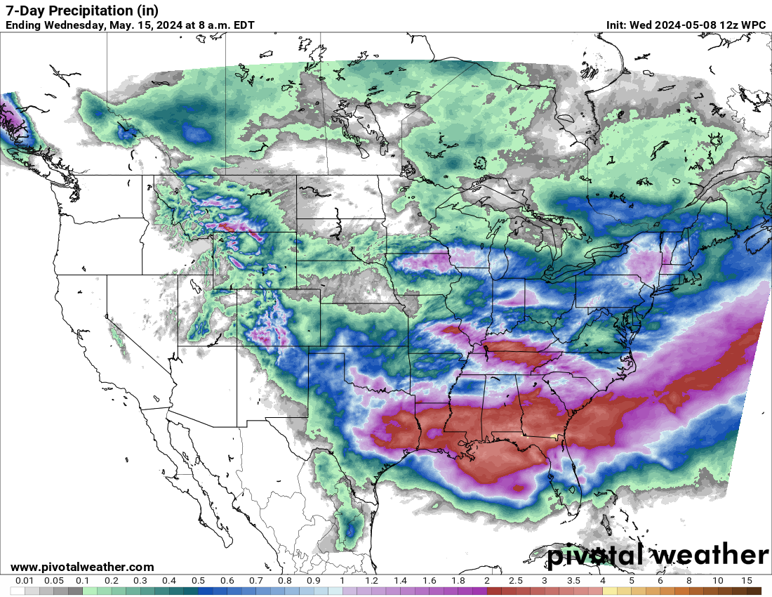
7-Day Precipitation (in)

click to enlarge
click to enlarge

click to enlarge
click to enlarge
GOES 16 Visible
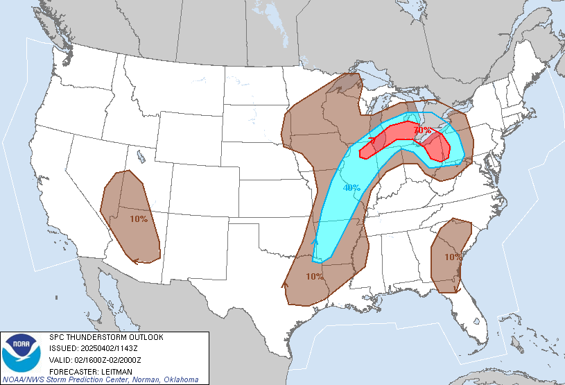
SPC Day 2 Thunderstorms
SPC Day 1 Outlook
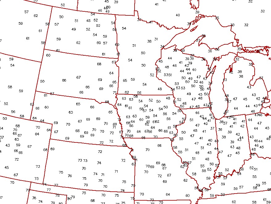
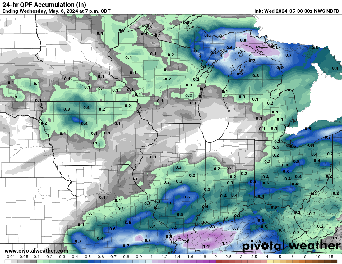
24 Hr QPF Regional
click to enlarge
click to enlarge

click to enlarge
click to enlarge
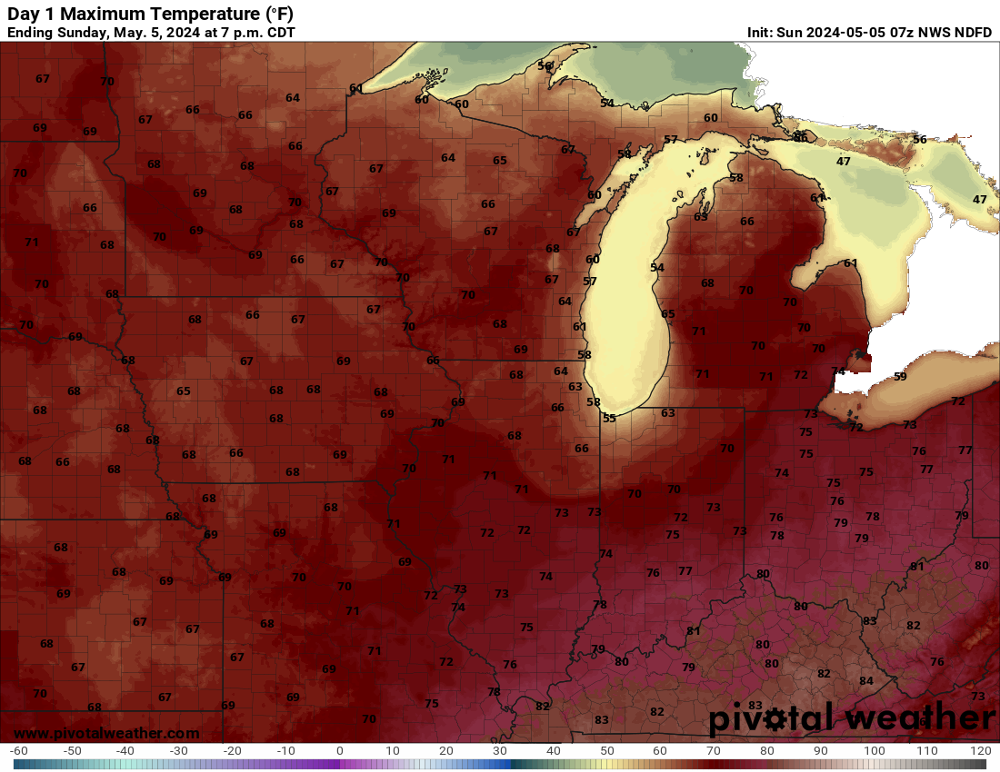
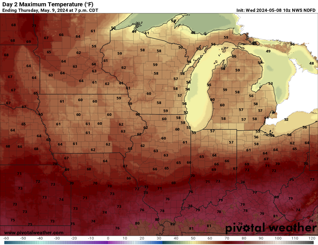
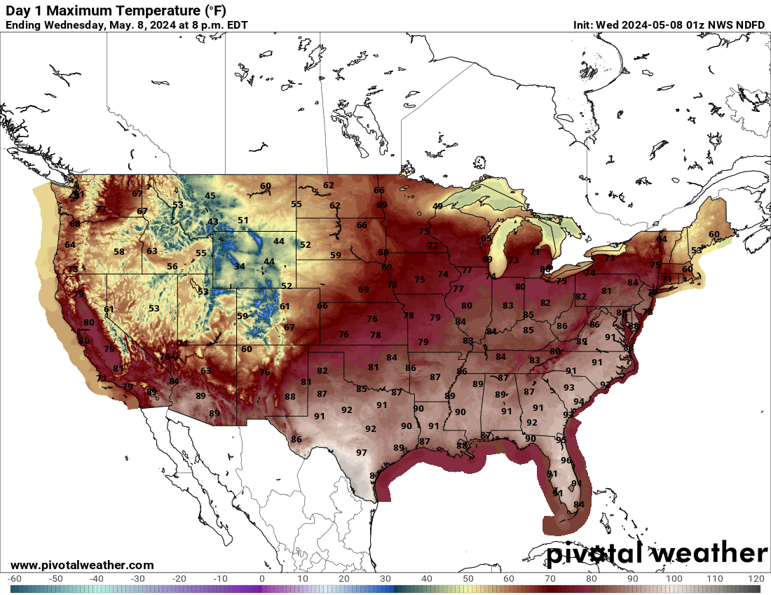
Day 1 Max Temps
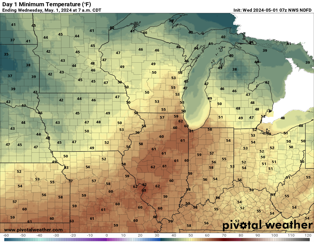
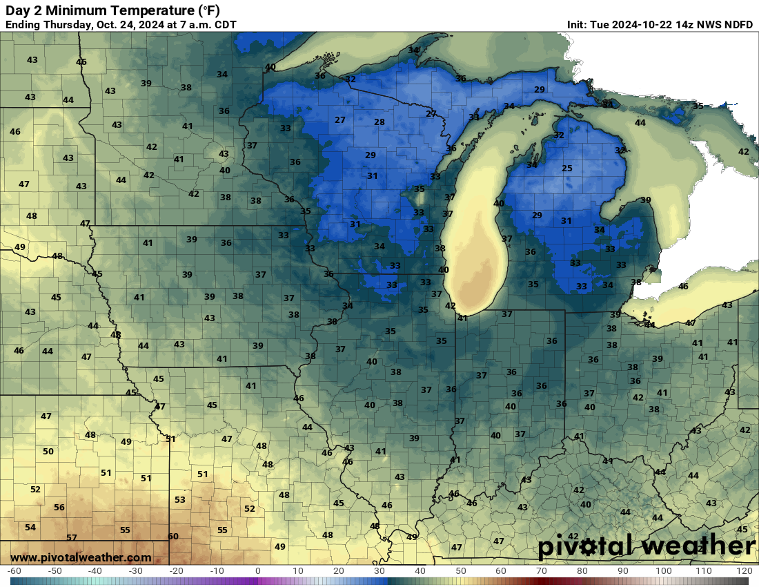
Day 1 Min Temps
Day 2 Max Temps
Day 2 Min Temps
click to enlarge
click to enlarge
click to enlarge
click to enlarge
Fire Wx Outlook
T-Storm Outlook
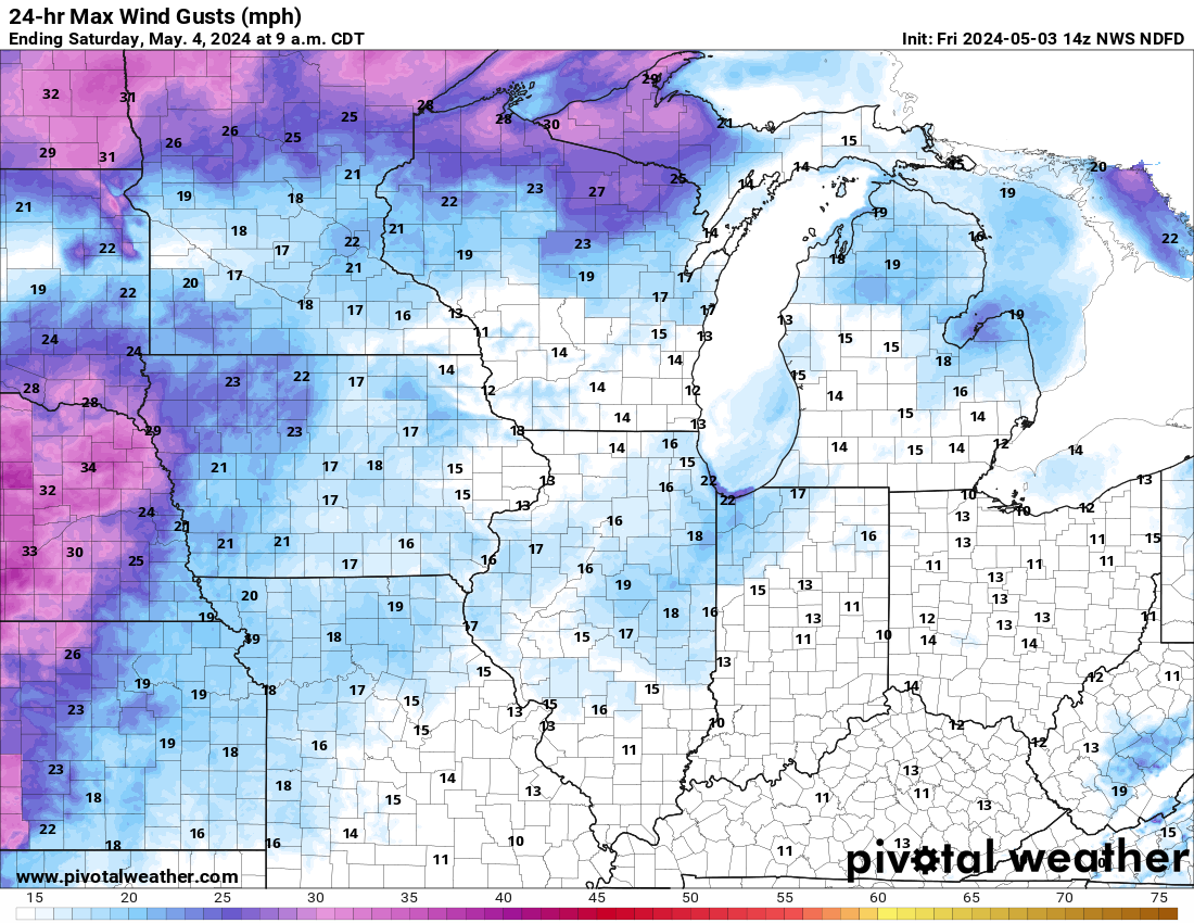
24 hr Max Winds
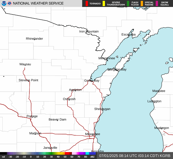
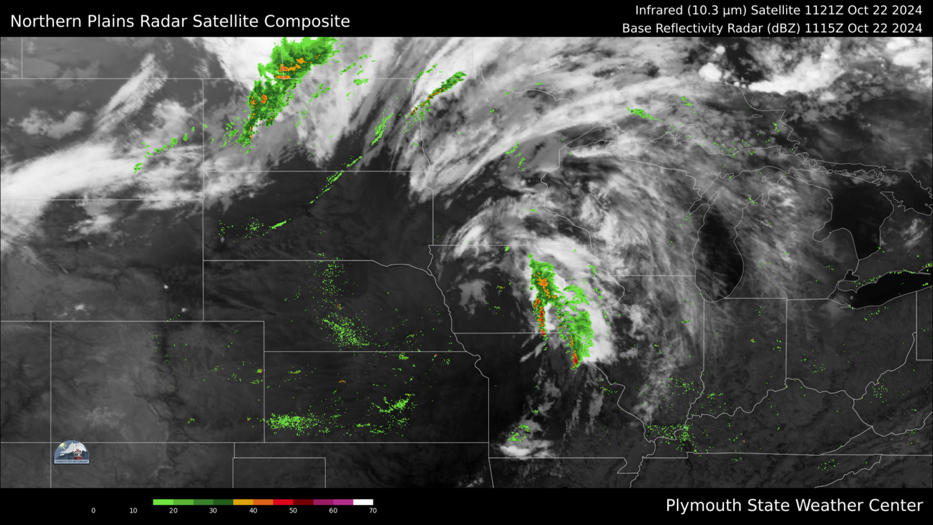
Infrared Radar

click to enlarge
click to enlarge
click to enlarge
click to enlarge
USA 1-Day Max Temp
Waupaca 2 Day Plotter
SPC Day 1 Tornado
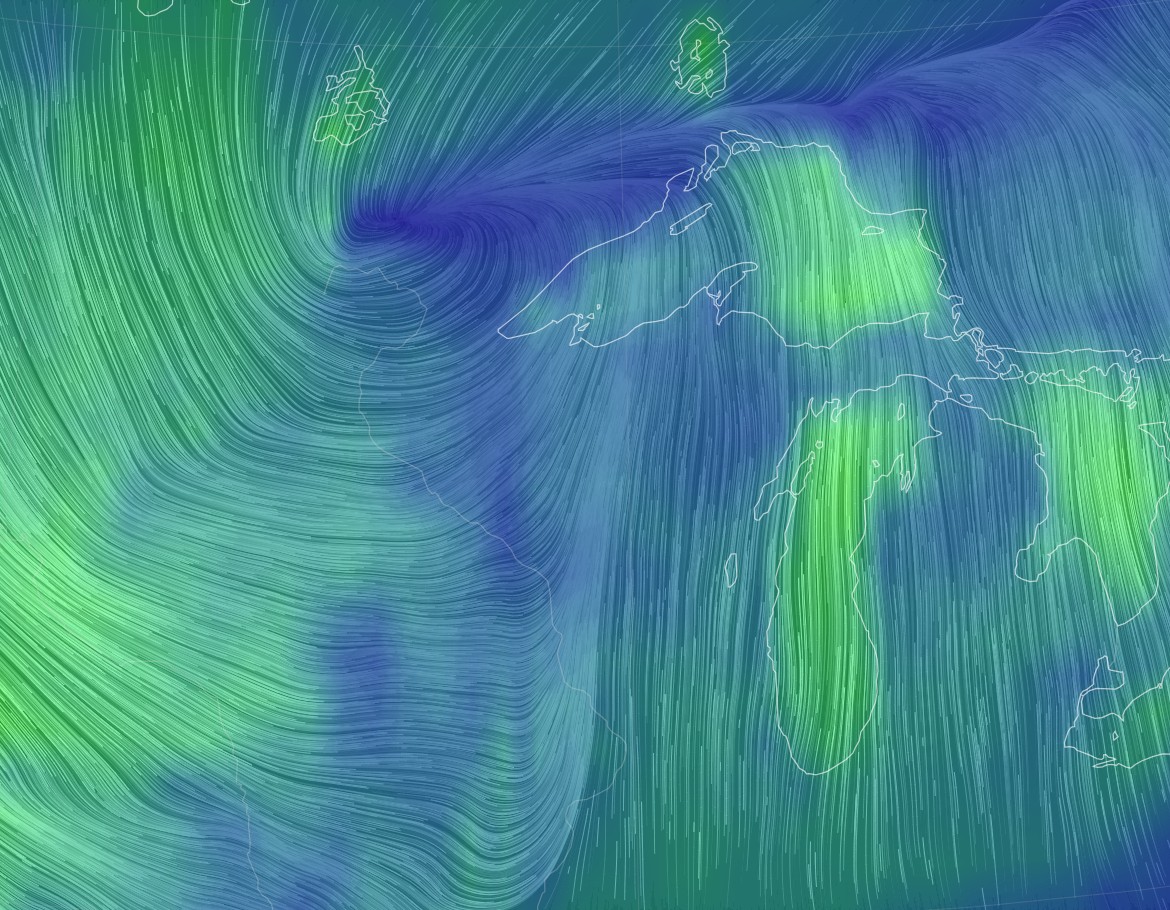
Google Earth Winds
click to enlarge
click to enlarge
click to enlarge
click to enlarge
Climatological Data
Statistical Information
Today
Yesterday
Monthly
Yearly
High Temperature
Low Temperature
26.1 at 0:13
25.9 at
0:00
25.9 at 23:53
1.6 at
7:42
26.1°F on 1/5/26
1.6°F on
1/4/26
26.1°F on 1/5/26
1.6°F on
1/4/26
High Humidity
Low Humidity
85 % at 0:00
85 % at
0:00
86 % at 10:09
72 % at 12:56
86 % on 1/4/26
46 % on
1/2/26
86 % on 1/4/26
46 % on
1/2/26
High Dew Point
Low Dew Point
22.2 at 0:13
22.0 at 0:00
22.0 at 23:53
-2.9 at 7:42
22.2°F on 1/5/26
-2.9°F on 1/4/26
22.2°F on 1/5/26
-2.9°F on 1/4/26
High Wind Speed
0.0mph at 0:00
4.0mph at 12:15
11.0mph on 1/2/26
11.0mph on 1/2/26
High Barometer
Low Barometer
28.84 at 0:01
28.83 at
0:16
29.25 at 10:12
28.84 at
23:59
29.25 on 1/4/26
28.83 on
1/5/26
29.25 on 1/4/26
28.83 on
1/5/26
Heating Degree Days
Cooling Degree Days
0.8 degree days
0.0 degree days
210.7 degree days
0.0 degree days
210.7 degree days
0.0 degree days
Evapotranspiration Hi
0.00" ETo at 0:00
0.00" ETo at 15:00
0.01" ETo on 1/2/26
0.01" ETo on 1/2/26
Solar Radiation Hi
0 at 0:00
195 at 10:50
260 on 1/2/26
260 on 1/2/26
Winter Weather Advisory issued January 4 at 7:12PM CST until January 5 at 3:00AM CST by NWS Green Bay WI
* WHAT...Mixed precipitation. Additional snow accumulations up to one inch and ice accumulations up to a tenth of an inch. * WHERE...Waushara, Calumet, Manitowoc, Winnebago, Brown, Kewaunee, Menominee, Outagamie, Shawano, and Waupaca Counties. * WHEN...Until 3 AM CST Monday. * IMPACTS...Slippery road conditions. * ADDITIONAL DETAILS...While the precipitation will end early Monday morning, road impacts may still occur into the Monday morning commute time.
| Temperature | Humidity | Barometer | Wind | ||||||||||||||||||||||||||||||||
26.1°F
(FEELS LIKE) 26.1°F |
85%(8% 24hr change) |
28.83(-0.31" 24hr change) |
0.0 - SSWWind Gust(0.0 mph) |
||||||||||||||||||||||||||||||||
| Temperature Chart | Dew Point-Humidity Chart | Precipitation Chart | Solar Radiation | ||||||||||||||||||||||||||||||||
|
|
|
|
|
||||||||||||||||||||||||||||||||
| Wind Chill | RH and Dew Point | Miscellaneous | Almanac | ||||||||||||||||||||||||||||||||
|
|
|
|
||||||||||||||||||||||||||||||||
| Daily Rainfall | Monthly Rainfall | Yearly Rainfall | 24 Hour Rainfall | ||||||||||||||||||||||||||||||||
|
|
|
|
||||||||||||||||||||||||||||||||
| Waupaca Fire Danger | Surface Temps | 24-Hr Temp Change | Saint Cloud Radar | ||||||||||||||||||||||||||||||||
|
|
|
|
||||||||||||||||||||||||||||||||
| Aviation Wx Center | Midwest Radar | Wisconsin Radar | Lightning Map | ||||||||||||||||||||||||||||||||
|
|
|
|
||||||||||||||||||||||||||||||||
| Day 1 Weather Map | Day 2 Weather Map | SPC Day 1 Tornado Outlook | 7-Day Precipitation (in) | ||||||||||||||||||||||||||||||||
|
|
|
|
||||||||||||||||||||||||||||||||
| GOES 16 Visible | SPC Day 2 Thunderstorms | SPC Day 1 Outlook | 24 Hr QPF Regional | ||||||||||||||||||||||||||||||||
|
|
|
|
||||||||||||||||||||||||||||||||
| Day 1 Max Temps | Day 1 Min Temps | Day 2 Max Temps | Day 2 Min Temps | ||||||||||||||||||||||||||||||||
|
|
|
|
||||||||||||||||||||||||||||||||
| Fire Wx Outlook | T-Storm Outlook | 24 hr Max Winds | Infrared Radar | |
|
|
|
||||||||||||||||||||||||||||
| USA 1-Day Max Temp | Waupaca 2 Day Plotter | SPC Day 1 Tornado | Google Earth Winds | |
|
|
|
Climatological Data
| Statistical Information | Today | Yesterday | Monthly | Yearly |
| High Temperature Low Temperature |
26.1 at 0:13 25.9 at 0:00 |
25.9 at 23:53 1.6 at 7:42 |
26.1°F on 1/5/26 1.6°F on 1/4/26 |
26.1°F on 1/5/26 1.6°F on 1/4/26 |
| High Humidity Low Humidity |
85 % at 0:00 85 % at 0:00 |
86 % at 10:09 72 % at 12:56 |
86 % on 1/4/26 46 % on 1/2/26 |
86 % on 1/4/26 46 % on 1/2/26 |
| High Dew Point Low Dew Point |
22.2 at 0:13 22.0 at 0:00 |
22.0 at 23:53 -2.9 at 7:42 |
22.2°F on 1/5/26 -2.9°F on 1/4/26 |
22.2°F on 1/5/26 -2.9°F on 1/4/26 |
| High Wind Speed | 0.0mph at 0:00 | 4.0mph at 12:15 | 11.0mph on 1/2/26 | 11.0mph on 1/2/26 |
| High Barometer Low Barometer |
28.84 at 0:01 28.83 at 0:16 |
29.25 at 10:12 28.84 at 23:59 |
29.25 on 1/4/26 28.83 on 1/5/26 |
29.25 on 1/4/26 28.83 on 1/5/26 |
| Heating Degree Days Cooling Degree Days |
0.8 degree days 0.0 degree days |
210.7 degree days 0.0 degree days |
210.7 degree days 0.0 degree days |
|
| Evapotranspiration Hi | 0.00" ETo at 0:00 | 0.00" ETo at 15:00 | 0.01" ETo on 1/2/26 | 0.01" ETo on 1/2/26 |
| Solar Radiation Hi | 0 at 0:00 | 195 at 10:50 | 260 on 1/2/26 | 260 on 1/2/26 |